
Experiment3 min read
Mapping the automotive world.
How geospatial data, user-generated content, and AI can unlock a richer driving experience.
 By SpotaLabs Team
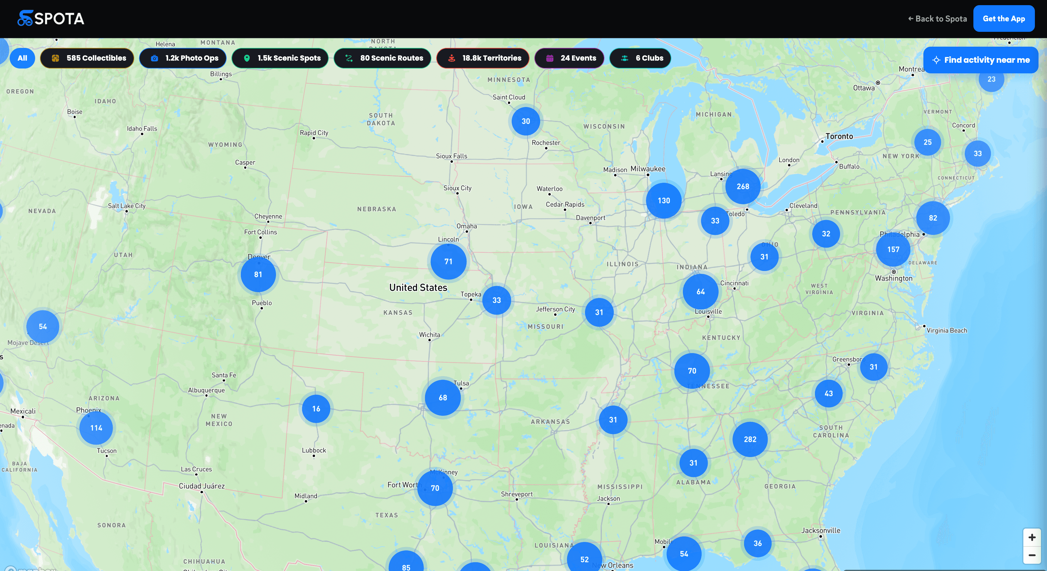
Navigation maps are extraordinarily good at one thing: getting you from A to B. They know every road, every junction and the traffic on each of them. What they don't know is which road is worth driving, where the local car scene meets on a Friday night, or which empty rooftop has the best view of the skyline for a photo of your car.
That knowledge exists. It lives in forum threads, group chats, social posts and the heads of local enthusiasts. It just isn't on a map. This Lab post is about an ongoing experiment behind Spota: building a map of the automotive world as car people see it.
A different kind of map layer
A car-culture map needs layers that navigation apps don't have:
- Roads worth driving: curves, elevation, scenery, surface quality and how quiet they are at different times.
- Places: meet spots, photo locations, scenic stops, tracks, cafes with good parking.
- Moments: meets and events that exist for a few hours and then disappear.
- People: who's driving nearby, who's in your crew, and where a convoy is heading.
Some of this comes from open geospatial data. Most of it can only come from the community.
What geospatial data gives us
Road geometry is surprisingly informative. From public map data you can derive how twisty a road is, how its elevation changes, how often it's interrupted by junctions, and what kind of road it is. That's enough to make a first guess at which roads might be fun: long, uninterrupted, curvy and not a main highway.
It's only a guess. A road that looks perfect in the data might be full of potholes, have a speed camera every mile, or be packed with traffic every weekend. Data can nominate candidates; it can't judge them.
What the community gives us
That's where user-generated content comes in. In Spota, drivers can add and rate spots, build playlists of places, and share photo ops. Every one of those is a piece of local knowledge placed on the map.
The experiment we're running is about combining the two: using geospatial signals to suggest where interesting things might be, and using community activity to confirm, correct and enrich them.
Where AI fits
We're exploring a few specific uses of machine learning, each aimed at making community content more useful rather than replacing it:
- Road scoring: combining road geometry with community ratings to rank routes for a particular kind of drive, such as a relaxed scenic cruise versus something more technical.
- Spot understanding: making sense of what people submit, like grouping duplicate submissions of the same place and tagging spots from their descriptions and photos.
- Recommendations: suggesting playlists and places based on where you drive and what you've enjoyed, instead of showing everyone the same list.
Hard problems we're still working on
Quality and trust. Anyone can add a pin. Keeping the map useful means filtering spam, resolving duplicates, and giving more weight to contributions the community confirms.
Privacy. Location data is sensitive. We think drivers should always control what's shared, precise locations of homes and regular routes should never be exposed, and live location should only be visible to people you've chosen.
Safety and responsibility. A map that rewards driving has to be careful about what it rewards. We design around discovering places and completing routes, not speed, and we don't want to send large numbers of cars to quiet residential streets.
Why it matters
The best drives most enthusiasts have ever had usually came from a tip, a friend who said "you have to try this road". A map built from those tips, organized well enough that anyone can use it, turns local knowledge into something the whole community can share.
That's the map we're trying to build. You can see where it's heading in Your city is becoming a game map.
- spota
- maps
- geospatial
- ugc
SpotaTrack your drives, build your garage, and join the community.